Brace for impact: Aussies prepare as cold front sweeps across the country with dangerous winds and flooding rain

Millions of residents are set to be soaked this week, as a cold front settles across almost every state in the country.
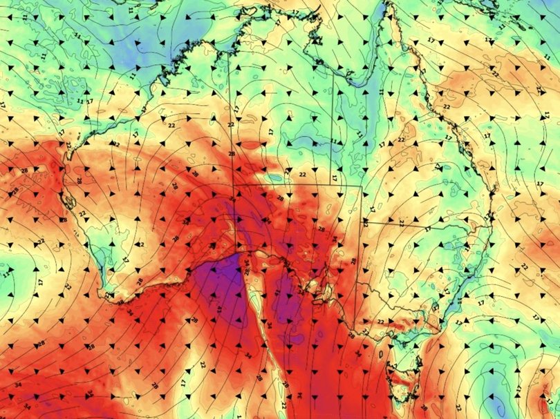
The cold front is sweeping across the southeastern coast of Australia, with heavy rain, destructive winds, snow and hail threatening to smash South Australia, Victoria, Tasmania and parts of NSW.
This is after a cold front passed over Western Australia on Monday, bringing wet weather, chilly temperatures and damaging winds.
Sign up to The Nightly's newsletters.
Get the first look at the digital newspaper, curated daily stories and breaking headlines delivered to your inbox.
By continuing you agree to our Terms and Privacy Policy.
Bureau of Meteorology senior meteorologist Angus Hines said winds would move from South Australia from Tuesday afternoon and head towards the east, picking up speeds of up to 80km/h in parts of Victoria and 110km/h in Tasmania.
“We actually saw one particularly strong wind gust at Mount Hotham in Victoria of 150km/h (overnight), which is really quite strong” Mr Hines said.
He said the extreme wind speeds at Mt Hotham were “a bit of an outlier”, but it could indicate the “strength of those very high-end gusts that are possible today”.

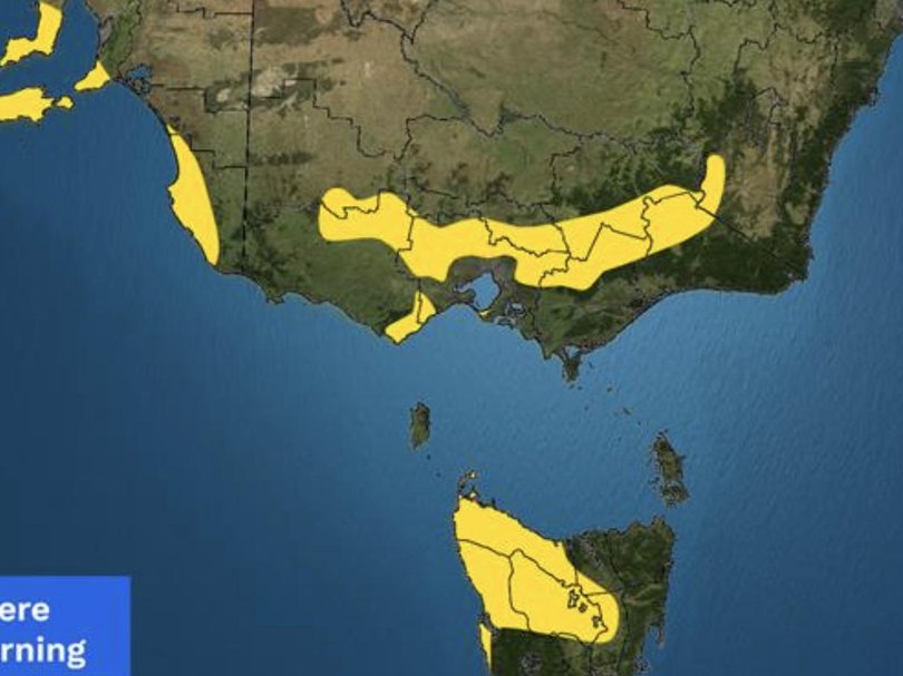
A severe weather warning has been issued for Victoria’s Great Dividing Range, as a strong northerly flow triggers destructive winds across northern Melbourne’s northern suburbs, the Mornington Peninsula, the Dandenong Ranges, the Otway ranges and the Surf Coast.
Locations possibly affected include Ballarat, Bacchus Marsh, Daylesford, Falls Creek, Tullamarine, Yarra Glen, Sorrento, the Dandenong Ranges, Mt Baw Baw and Kyneton.
“We could see more gusts of 90, 100, 120 kilometres an hour, (with the) potential for some branches and trees down, property damage, power outages, that kind of thing,” he said.

The wild weather will also hit much of northwestern Tasmania.
The bureau issued a severe weather warning issued for the North-West Coast, Western, Central Plateau, Central North and Midlands districts, with gusts expected to reach in excess of 110km/h.
Locations that may be affected by the damaging wind gusts include Devonport, Burnie, Strahan, Smithton, Oatlands and Bothwell.
The wind is also “sneaking across the state border into the Snowy Mountains of NSW”, Mr Hines told NewsWire.
“So lots of damaging wind warnings for today,” he said.
Aside from the destructive winds, Mr Hines said residents could also expect to see “a little bit of snow” and “a little hail” but clarified the conditions wouldn’t be “too significant”.

The bureau also warned of plummeting temperatures.
“(We can expect) some chillier temperatures as well spreading across the country, sort of behind the system in the wake of it as it moves through,” he said.
“July often our coldest month, so even if we see temperatures of two or three degrees below average at this time of year, that’s a pretty cold day, particularly across the southern parts of the country.”

The icy conditions are expected to continue, with a second cold front forecast to hit Western Australia on Wednesday, starting in Perth and spreading across to Sydney by the weekend, bringing another cold snap and plenty of wet weather with it.
“(The second cold front) will follow that very typical pattern that we see a lot of these weather systems do,” Mr Hines said.
“Starting off in Perth in the west and then making its way across the southeast and then getting across to Sydney.”
He said it would take “a few days” for the front to move east but cautioned it contained “a lot more tropical moisture” than the first cold front, meaning residents are set to be soaked.
“This next weather system coming in a few days’ time is going to bring more extensive and heavier rain as it crosses over the country,” Mr Hines said.
The rain will likely blanket almost every state and territory in the country, including Western Australia, “almost all” of South Australia, Victoria, Tasmania, NSW and “even the majority” of Queensland.

On Tuesday, Brisbane residents can expect a partly cloudy day with a medium chance of showers and a top of 22C.
It will also be partly cloudy for Sydney, with a chance of showers in the evening and a maximum temperature of 20C.
Canberra will cop cloudy skies and a high chance of showers, with a top of 16C.
Melbourne residents can expect a very high chance of showers and damaging winds, with a top of 16C.
It will be similar in Hobart on Tuesday, with a high chance of showers in the afternoon and evening and a top of 17C.
In Adelaide, residents can expect lots of showers and a small chance of hail, with strong winds and a maximum temperature of 13C.
Perth residents will see cloudy skies and a very high chance of showers, with a top of 17C.
In Darwin, the forecast is for light winds, partly cloudy skies and a top of 31C.
Originally published as Millions in firing line as enormous cold front smashes almost every state
