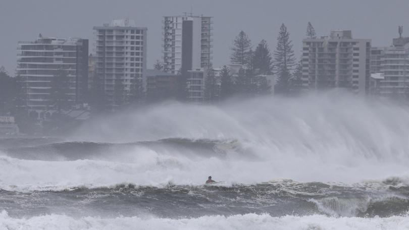
Cyclone Alfred: Latest update from Bureau of Meteorology as tropical system makes landfall
The Bureau of Meteorology has issued updated advice as Tropical Cyclone Alfred arrives, bringing destructive conditions to Queensland and New South Wales.

The Bureau of Meteorology has issued updated advice as Tropical Cyclone Alfred arrives, with flooding now one of the biggest concerns.
“Ex-Tropical Cyclone Alfred lies off Bribie Island and is moving slowly north.” the Bureau said in an update at 6am AEST (7am AEDT).
“Gales are no longer occurring over coastal or island locations.
Sign up to The Nightly's newsletters.
Get the first look at the digital newspaper, curated daily stories and breaking headlines delivered to your inbox.
By continuing you agree to our Terms and Privacy Policy.“It is expected to move towards and cross the mainland coast this morning, with winds weakening further as it moves inland.
“Despite its weakening, heavy rainfall is likely to continue over southeast Queensland and northeast New South Wales during the weekend.”
Follow the The Nightly’s Cyclone Alfred live blog for the latest updates
Tropical Cyclone Alfred now category one
Cyclone Alfred is now a category one system, weakening slightly as it approached.
The Bureau says the system has an intensity with sustained winds near the centre of 55km/h with wind gusts to 85km/h.
Current hazards from Tropical Cyclone Alfred
Heavy rainfall is expected to continue over southeast Queensland and northeast New South Wales during the weekend.
Heavy to locally intense rainfall, which may lead to dangerous and life-threatening flash flooding, may occur over coastal and adjacent inland areas of southeast Queensland as ex-Cyclone Alfred moves inland today.
Flood watches, and flood warnings are current for southeast Queensland and northeast New South Wales.
Abnormally high tides are no longer occurring along the coastal areas but are expected to be higher than normal over the weekend.
However, damaging surf may continue with significant beach erosion for the open beaches between Noosa and Ballina during the weekend.
Separate Coastal Hazard and Hazardous Surf warnings are current for southeast Queensland and New South Wales coasts.
Gales with damaging wind gusts are no longer occurring near ex-cyclone Alfred’s centre or over offshore areas.
