Jane Bunn weather: More rain to smash large parts of Queensland weeks after Cyclone Alfred hit
There is plenty of rain still to come but one low pressure system is being stubborn and will at least give some regions relief.
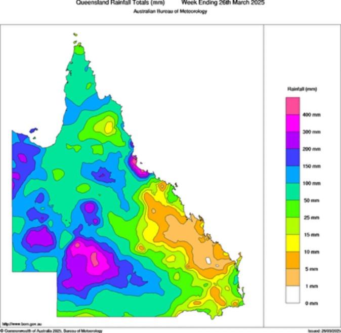
In the past week, large parts of Queensland have recorded more than 200mm of rain, and locally more than 400mm.
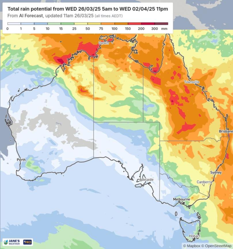
Forecasts show that the weather system still has a lot to deliver, with more than 200mm still to come.
The last big widespread rain system for Queensland, a few weeks ago, delivered heavy rain to the northern coast and parts of the northern inland.
Sign up to The Nightly's newsletters.
Get the first look at the digital newspaper, curated daily stories and breaking headlines delivered to your inbox.
By continuing you agree to our Terms and Privacy Policy.Cyclone Alfred then delivered huge totals for southeast Queensland and northeast NSW.
But this one is being felt in previously dry parts of the southern inland ... and it should continue moving even further south in the days ahead.
It’s not often that you see a weekly rainfall totals map where not an inch of the entire state remained dry.

The prior rain, plus all the new rain has to go somewhere, and it is our river systems that channel all that water and move it along.
On the coast it goes straight out to sea, but most of the rain that falls west of the Great Divide heads westwards and southwards, soaking through the Murray Darling Basin on its way through NSW, then Victoria and South Australia.
While the initial rain can have a detrimental effect on the fruit and vegetables in our supermarkets, there are longer term benefits by introducing much needed water into the ground through the huge basin where the majority of our fresh produce is grown.
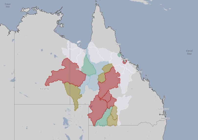
The flood watches and warnings show just how much of Queensland’s catchments are currently flooding or have the potential for flooding in the days ahead.
Anything coloured in red is major flooding.

Looking ahead, and there is still a lot of rain to come.
While this weather system will concentrate its heaviest rain over inland parts of Queensland, there will be significant falls stretching far and wide from the epicentre.
The forecast map shows that you can essentially draw a line down the middle of Australia, with rain to the northeastern side, and hardly anything to the southwestern side.
The rain is produced by moist winds coming in from the incredibly warmer than average seas to our north and east, and running into low pressure.
This is the catalyst to turn it from humid air into moisture-laden clouds that produce rain, rather than drier clouds that don’t produce much at all.

The low pressure producing this rain is stubborn and wants to sit along that boundary.
In order to get rain to its southwest, the low pressure needs to move — and the modelling doesn’t have that in the outlook.
So the dry areas to the southwest are likely to remain quite dry, as the rain can’t cross that boundary.
