Weekend weather forecast: Stormy blast to lash Australia’s south and west in first weekend of spring
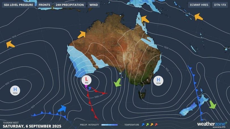
Wild weather is set to batter Australia’s southwest through the first weekend of spring, with heavy rain, thunderstorms and powerful winds forecast.
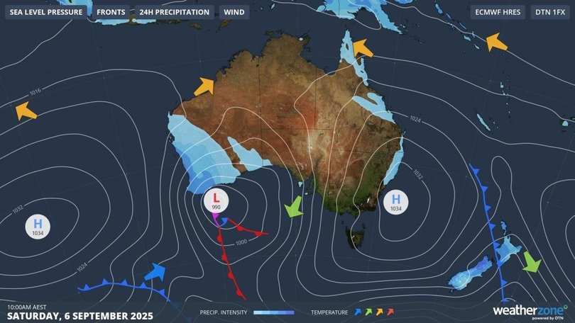
A cold front is expected to sweep the west coast from Friday, with a low pressure system driving wet and windy conditions into Saturday.
The Bureau of Meteorology has warned of widespread rain and storms, with up to 40mm possible across the South West Land Division and heavier falls likely between Geraldton and Esperance.
Sign up to The Nightly's newsletters.
Get the first look at the digital newspaper, curated daily stories and breaking headlines delivered to your inbox.
By continuing you agree to our Terms and Privacy Policy.Perth is forecast to be lashed by thunderstorms and a very high chance of rain on Friday, with strong winds building into the night.
A strong wind warning is in place for multiple coastal areas on Friday, including Perth Local Waters, Ningaloo, Gascoyne, Geraldton, Lancelin, Bunbury Geographe and Leeuwin coasts.
Conditions will escalate on Saturday, with a gale warning issued for the Bunbury Geographe, Leeuwin, Albany and Esperance coasts.
“A cold front traversing southwest Western Australia combines with rich moisture to produce the risk of severe thunderstorms (on Friday) morning,” the Bureau warned.
“Severe thunderstorms are likely to produce damaging winds and heavy rainfall that may lead to flash flooding.”
The strongest gusts are expected Friday night into Saturday as the low deepens, with damaging winds a real risk in storm-hit regions.
The unsettled weather in WA will linger through the weekend, with showers and thunderstorms spreading inland to the Goldfields and Eucla.
Perth will hover near 20C with gusty coastal winds.
“Into Sunday, there’ll still be some showers as another little front runs across the southwest to round out the weekend’s wet weather,” Sky News meteorologist Rob Sharpe said.
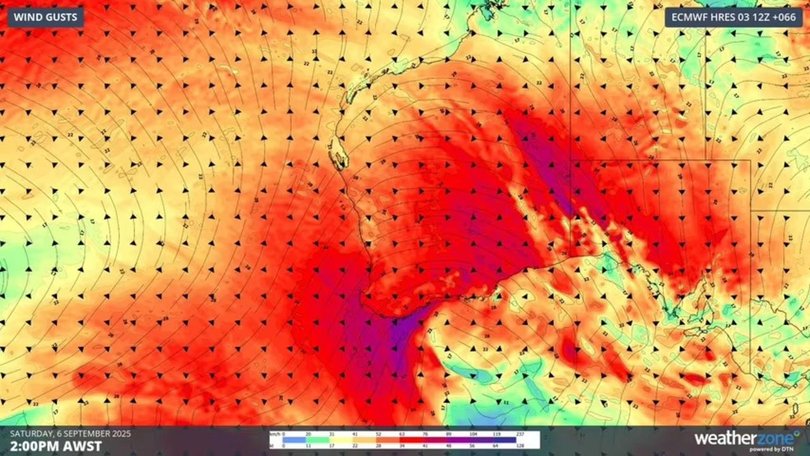
South Australia is also bracing for a blast, with a severe weather warning for damaging winds issued on Friday morning.
Gusts of up to 90km/h are expected across the West Coast on Saturday, affecting Ceduna, Wudinna, Elliston and Streaky Bay.
Strong wind warnings are also in place for large stretches of the SA coastline across both Friday and Saturday.
Tasmania is also on alert for severe frost on Saturday morning, with temperatures forecast to plunge to -5C in parts of the Midlands and Upper Derwent Valley, cold enough to cause significant crop damage.
A strong wind warning has been issued for the state’s Far North West Coast on Saturday.
Hobart will warm briefly to 15C on Saturday and 20C on Sunday before cooling again next week.
Victoria, meanwhile, faces a sharp contrast. Saturday will begin sunny and mild, reaching around 21C in Melbourne, before thickening cloud and showers move in later in the day.
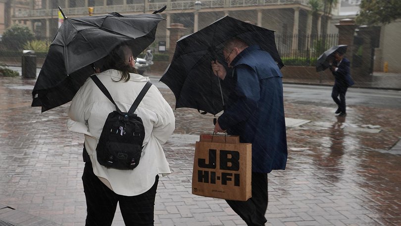
Sunday is set to turn wild, with widespread rain, thunderstorms and damaging winds likely across central and western districts, while alpine areas could even see snow.
A Frost Warning is in place for Saturday morning, with temperatures dipping as low as -2C across parts of the state.
Canberra is set for frosts on Saturday morning, followed by a sunny 20C, before gusty north-westerlies sweep in with showers likely on Sunday.
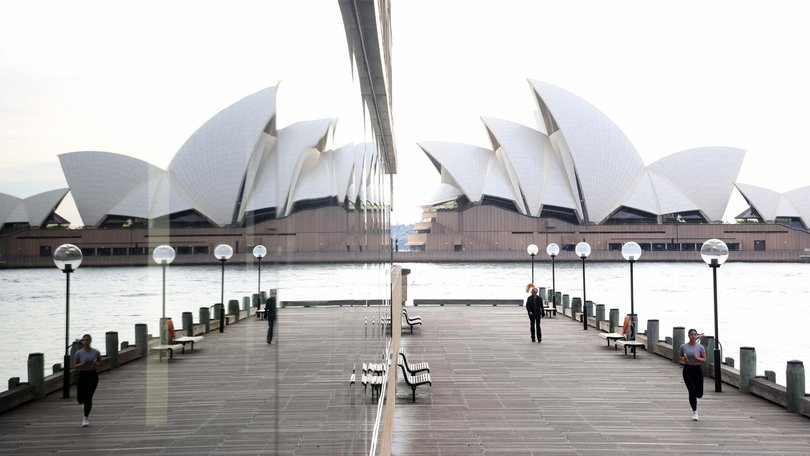
For NSW, it’s a much gentler picture. Sydney should enjoy highs of 20C on Saturday and 23C on Sunday under blue skies – the start of a five-day run of warm, sunny conditions peaking at 27C on Monday.
Inland areas may see showers late Sunday as Victoria’s system pushes north.
Queensland is tipped to remain steady, with warm conditions through the southeast and the chance of afternoon showers and storms in the tropics. Brisbane will reach 27C with a chance of showers.
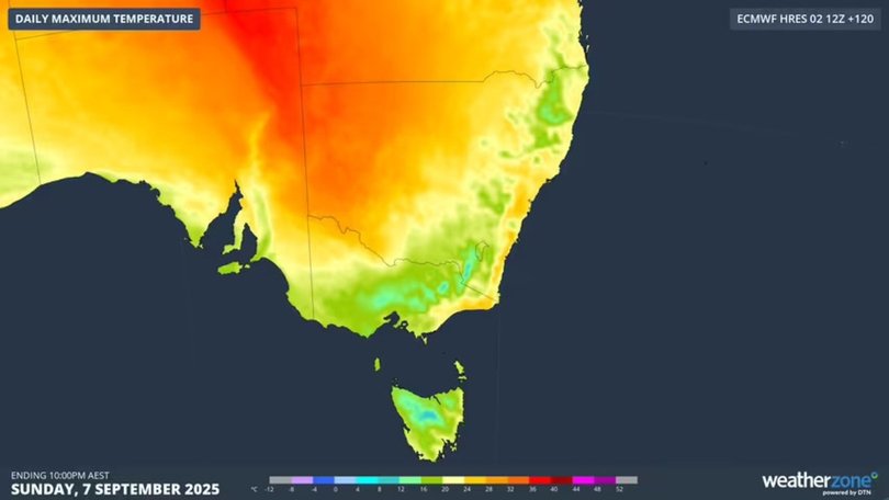
While the southwest braces for winter-like storms, some southeastern towns will enjoy their warmest weekend in months.
Mildura is tipped to reach 30C on Saturday, Renmark could see 30C on both days, and Oodnadatta in SA’s northeast is expected to soar to 35C on Saturday – its hottest day since March.
It all sets up a wild split for Father’s Day: stormy, blustery conditions for the southwest, and a taste of summer warmth across much of the southeast.
What’s driving wild weather
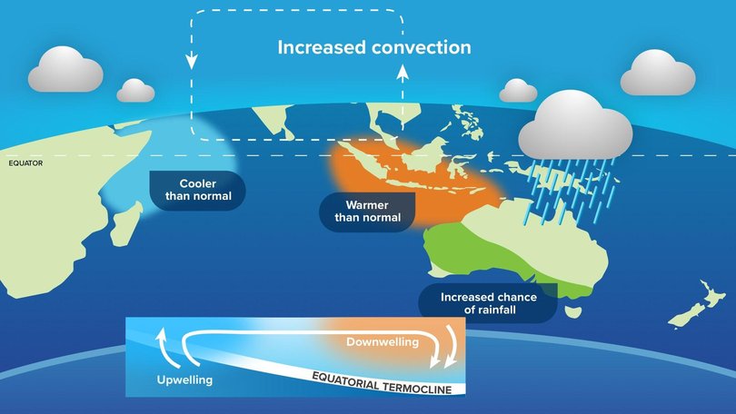
The weekend’s turbulence is unfolding against a backdrop of global climate patterns shifting into gear.
The Bureau’s seasonal outlook notes the El Nino–Southern Oscillation remains neutral for now, but international forecasts give up to a 60 per cent chance of La Nina conditions developing by summer.
La Nina typically means wetter weather for eastern and northern Australia.
Meanwhile, the Indian Ocean Dipole (IOD) is in the early stages of a strong negative phase, a climate driver known to funnel moist air toward Australia.
The IOD index recently fell to – 1.28C, one of its lowest values on record since 2008. Negative IOD years - including 2010, 2016, 2021 and 2022 - have often brought widespread spring rainfall.
That could spell more rain ahead this spring, especially for NSW and Victoria.
Sydney has already endured its wettest winter in nearly 20 years, copping 567mm across June, July and August, almost double the long-term average.
Warragamba Dam remains at 99 per cent capacity after the deluge.
Originally published as Stormy blast to lash Australia’s south and west in first weekend of spring
