Tropical Cyclone Fina: Category 1 cyclone expected to make landfall on Friday
The tropical cyclone is expected to potentially make landfall by the end of the week.
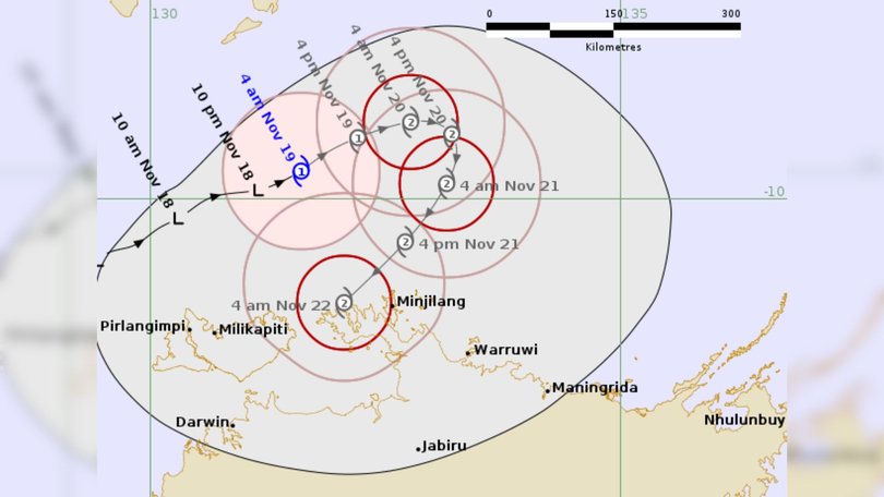
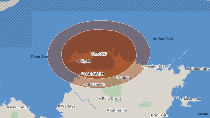
Tropical Cyclone Fina has officially formed north of Darwin and is expected to make landfall as early as Friday.
The Bureau of Meteorology upgraded the low pressure system into tropical cyclone status overnight as wind gusts reached 100km/h, catapulting it into a CAT 1 system.
Fina is expected to continue moving to the east northeast and intensify to CAT 2 by Wednesday night before making a U-turn and swinging southwest towards the Northern Territory coast for a potential impact as early as Friday.
Sign up to The Nightly's newsletters.
Get the first look at the digital newspaper, curated daily stories and breaking headlines delivered to your inbox.
By continuing you agree to our Terms and Privacy Policy.Senior meteorologist Miriam Bradbury said the storm is currently about 300km north of Darwin and travelling at a slow 9km/h.
“We may see a coastal crossing sometime over the weekend or into early next week,” she said.
“However, there are a range of forecast scenarios for where the system might move and how it might develop, this includes the possibility that the system peters out before it reaches the coast, or that it moves further east or west and avoids a coastal crossing altogether.
“It’s something that will be monitored very closely by our tropical cyclone team over the next few days.”

Fina is the first tropical cyclone of the 2025-2026 cyclone season, with experts saying it is predicted to be the earliest to cross since records began.
“The earliest tropical cyclone coastal crossing that we have on record, since the tropical cyclone data began about 1980-1981, was tropical cyclone Alessia on November 27, 2013,” Bradbury said.
What can we expect?
“Communities over the Northern Territory are not expected to be directly impacted by tropical cyclone Fina within the next 48 hours,” Bradbury said.
“We are likely to see showers and thunderstorms across northern parts of the top end over the next couple of days with the risk of heavy falls, but Tropical Cyclone Fina is currently located a little too far away from the coast to be having a direct impact on the weather, this is just normal build-up season weather.
“However, once we see the risk of gales developing along the Northern Territory coast in the next 48 hours, we will issue a tropical cyclone watch, really just flagging that imminent risk of tropical cyclone impacts.”

On average, there are 10 tropical cyclones in the Australian region each season, with three to four making landfall.
Tropical cyclones can cause damaging winds, heavy rainfall and flooding, large waves, storm surge and coastal inundation.
Originally published on 7NEWS
