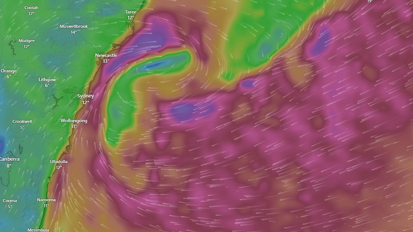
What is a bomb cyclone? The intense weather system about to hit New South Wales explained
Torrential rain, destructive winds, and dangerous surf conditions. NSW is about to be hit with a violent and rapidly intensifying low-pressure system. Here is what you need to know about the weather event.

According to the Bureau of Meteorology, New South Wales could see more than 200mm of rain in just 48 hours, which is double the average rainfall for all of July.
The violent and rapidly intensifying low-pressure system is expected to unleash huge ocean swells, torrential rain, and gale-force winds strong enough to topple trees and bring down power lines.
What is a bomb cyclone?
Sign up to The Nightly's newsletters.
Get the first look at the digital newspaper, curated daily stories and breaking headlines delivered to your inbox.
By continuing you agree to our Terms and Privacy Policy.Dubbed a “bomb cyclone,” the system is technically known as bombogenesis, which is a rapidly developing storm that forms when atmospheric pressure drops sharply over a short period, creating an unstable air mass.
The exact threshold for this pressure drop varies with latitude. In the Tasman Sea, it ranges from a fall of 18 hectopascals in 24 hours near Tasmania to 13 hectopascals closer to the NSW-Queensland border.
This particular system is forecast to drop between 22 and 24 hectopascals per day, easily surpassing the bombogenesis threshold.
The result? Torrential rain, destructive winds, and dangerous surf conditions across much of NSW.
The Bureau’s Community Information Lead, Angus Hines, said that the current event is shaping to bring most of the rainfall south, but warned it could take a subtle shift to bring some heavier rain into the mid north coast.
Is it as serious as the name suggests?
The weather system is of serious concern to residents who live in flood-prone areas, many of which are still recovering from May’s deadly floods.
The NSW SES has issued warnings to those in Taree, Newcastle, Gosford, Sydney, Wollongong, and Port Macquarie to prepare for dangerous and destructive winds.
SES Deputy Commissioner Debbie Platz said 400 volunteers are on standby across high-risk areas, including Kiama, Albury, Hawkesbury, Maitland, and Dungog.
In addition to the chance of flooding, densely populated areas are being hit with intensifying gusts that could bring down infrastructure, trees and create hazardous conditions.
All residents in impacted areas are being urged to put away items around the home, keep cars under cover, and away from trees and power lines.
The SES has also reminded people to not drive, ride or walk through any floodwaters.
When is it coming?
According to the Bureau, Tuesday and Wednesday will be the two biggest days in regards to rainfall and weather impacts.
A warning was issued at 11am on Monday that stated a “rapidly deepening complex low pressure system is forecast to develop a vigorous Coastal Low offshore of the Mid North Coast overnight, then slowly track southwards during Tuesday.”
“Winds are forecast to strengthen along the coastal fringe from Tuesday morning, extending to the northern ranges and their eastern lee slopes from Tuesday evening.”
The Bureau’s Hazard Preparedness Manager Steve Bernasconi said the system would be at its most intense on Wednesday and produce destructive winds and coastal erosion to large stretches of coast.
“As we move into Thursday, rain will ease, the winds and the surf may still remain a hazard, and on Friday conditions are expected to improve,” Mr Bernasconi said.
