Queensland cyclone warning: Residents hunker down as brewing cyclone eyes coast
A tropical low is threatening to develop into a cyclone as it approaches a region already reeling from heavy flooding that has isolated communities.

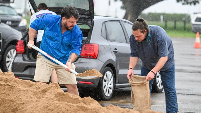
Residents in Queensland’s far north have been warned to take shelter as a slow-moving potential cyclone eyes the coast.
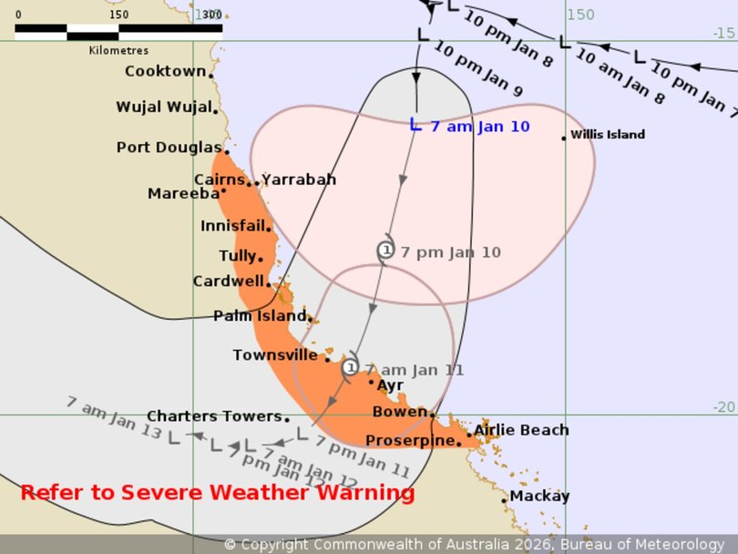
The tropical low is forecast to reach maximum intensity late Saturday evening before making landfall near Townsville early Sunday.
Authorities warn conditions will be dangerous as the system approaches, with gale-strength winds likely from late afternoon.
Sign up to The Nightly's newsletters.
Get the first look at the digital newspaper, curated daily stories and breaking headlines delivered to your inbox.
By continuing you agree to our Terms and Privacy Policy.Should Cyclone Koji eventuate, its force will knock down trees and powerlines, and blow away anything not tied down outside, according to the emergency warning.
“This is a risk to life. Heavy rain may cause flooding in some places,” the warning says.
“Power, phones, internet and water might stop working. Roads could be blocked by fallen trees, powerlines or flood water.”
Premier David Crisafulli was adamant earlier on Saturday that the already hard-hit region was “better prepared than ever” to handle the challenge.
“Tropical Low 12U moving closer to the north-east Queensland coast and is forecast to reach tropical cyclone intensity this afternoon as a category 2 system,” the Bureau of Meteorology said.
Koji was expected to deliver 100km/h wind gusts, heavy downpours in already soaked catchment areas and a risk of flash floods.
“Rainfall will ramp up later today and into tomorrow through firstly the Central Coast region and then into the Herbert and lower Burdekin,” Bureau of Meteorology forecaster Dean Narramore said.
“There are severe weather warnings from Port Douglas down to Mackay and cyclone warnings are also current from Port Douglas into the Ayr area.”
Despite the concern, Mr Crisafulli said swift-water rescue craft, police, SES officers and paramedics were in position and would work with residents on the ground.

“The locals know their patch and the challenges,” he said.
“In many ways, it has replicated what we saw a little less than 12 months ago when people from the north and central and western parts helped colleagues in the southeast.
“I want Queenslanders to know we are better prepared than ever.”
Whether 12U developed into a cyclone or not, the impacts would likely be the same, Bureau of Meteorology forecaster Angus Hines said on Friday.
He said widespread flooding was expected after the system crossed the coast and predicted rainfall totals of up to 350mm.
“That is a whole lot of wet weather,” he said.
From Sunday, the focus will likely shift south, with the tropical low gradually moving inland from central Queensland.
In the northwest, major flooding that has already heavily affected Gulf Country communities - where livestock losses are projected to be significant - continues on the Flinders River.
Major flood warnings have also been issued for the Herbert, Haughton and Tully rivers.
The federal and Queensland governments have activated funding support for primary producers in flooded areas.
Under the arrangements, farmers can claim eligible veterinary fees associated with the health and welfare of production livestock, as well as costs associated with carcass disposal on their property.
Freight subsidies up to $5000 per property will be made available to move essential materials including fodder, building and fencing materials, machinery and animals for restocking.
Mr Crisafulli said a preliminary survey of property owners indicated some 40,000 stock had already been lost, a number he expected would increase significantly.
