Cyclone Zelia recap: Warralong residents airlifted to safety as flooding isolates community
Ex-Tropical Cyclone Zelia caused intense rainfall and flooding in the State’s north.
RECAP: Ex-Tropical Cyclone Zelia casued intense rainfall and flooding in the State’s north.
Thanks for following our updates, read the recap of events in the blog below.
Key events
15 Feb 2025 - 05:15 PM
Road closures as of 5pm Saturday
15 Feb 2025 - 03:13 PM
Schools closed until safety inspections complete
15 Feb 2025 - 02:56 PM
Jigalong faces Telstra outage after TC Zelia
15 Feb 2025 - 01:26 PM
Carlindie Station residents safe despite ‘losing everything’
15 Feb 2025 - 12:13 PM
Stern warning for floodwater flouters
15 Feb 2025 - 09:04 AM
Premier speaks in Perth
Stern warning for floodwater flouters
DFES Commissioner Darren Klemm’s advice was plain and simple regarding driving in floodwaters this morning.
“Don’t attempt to drive through flooded roads. It’s incredibly dangerous,” he said.
“Floods can take control of a four-wheel drive in just 30cm of flowing water.
“Nine out of 10 floodwater deaths on WA roads involve a local motorist.”
The stern warning extended to those on foot as well.
“Don’t walk, swim or play in floodwaters, it is far too dangerous.”
Carlindie Station damaged
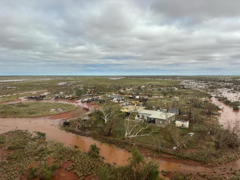
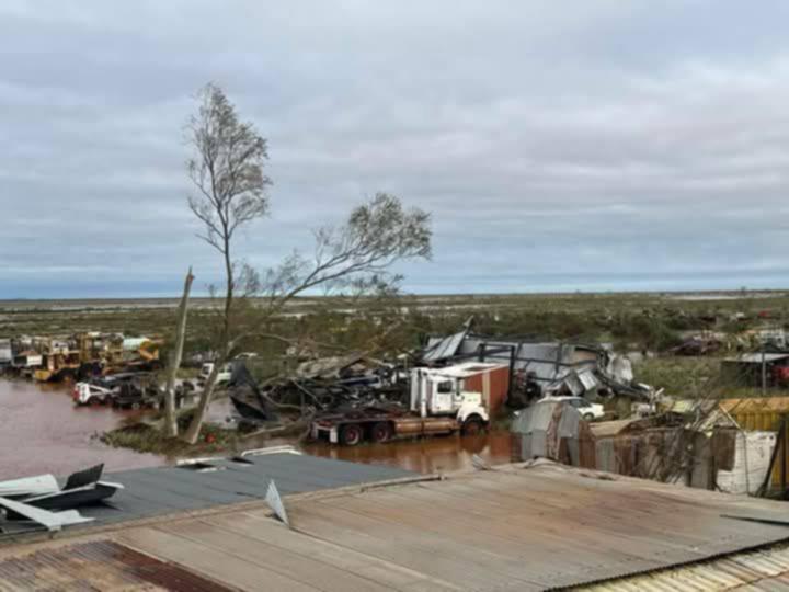
Locals are rallying around the owners of Carlindie Station after pictures have emerged showing the devastating impact of Cyclone Zelia.
The station - which is 75km southeast of Hedland - copped the brunt of the severe weather system, with images showing roofs torn off, trees fallen and buildings badly damaged.


River rises continue as records shattered
Rainfall and river records have been smashed left right and centre thanks to ex-tropical cyclone Zelia.
In the 24 hours to 9am this morning, these weather stations recorded the heaviest rainfall totals:
- 278mm at Upper North Pole
- 202mm at Marble Bar TM
- 165.6mm at Telfer Aero
And these areas have shattered annual or monthly records with their rainfall in the 72 hours to 9am yesterday:
- De Grey: 580.4mm - annual record, previous record 435.0mm 28-30 March 1988 (95 years of data)
- Pardoo Station: 518.2 mm - annual record, previous record 379.0mm 26-28 March 2007 (113 years of data)
- Mandora: 286.8 mm - February record, previous record 286.6mm 16-18 Feb 2018 (103 years of data)
- Port Hedland Airport: 218.6 mm - highest since March 2019 (84 years of data)
Record-breaking flood levels have also been observed in the De Grey River, with a peak at the Coongan River near Marble Bar clocking 10.2m - almost 2m above the last record of 8.3m.
River gauges across the De Grey tributaries continue to show rapid rises, which are expected to continue into today.
The Bureau of Meteorology is expecting a prolonged flood peak lasting days if not the whole week.
Premier speaks in Perth
No loss of life or injury has been reported overnight, Premier Roger Cook has said at a press conference in Perth this morning.
He says the Government is working with the major supermarkets to ensure supplies are made available and with the Federal Government for major disaster relief grants.
“We’re not quite out of the woods yet,” he said, reiterating warnings of flooding to come.
Originally published on PerthNow
