NSW bomb cyclone weather updates live: Sydney, Hunter region, South Coast hit hard as heavy rain causes chaos
A destructive bomb cyclone is battering NSW’s central and south coasts, cutting power to nearly 40,000 homes and triggering severe weather warnings statewide.
Scroll down for the latest news and updates.
Key events
02 Jul 2025 - 01:35 PM
Flood rescues and fierce winds as storm system lashes NSW
02 Jul 2025 - 01:25 PM
Fury as the ocean threatens to engulf Wamberal waterfront homes
02 Jul 2025 - 11:19 AM
More destruction across the state pictured
02 Jul 2025 - 10:39 AM
SES issues ‘prepare to evacuate’ warning for Sussex Inlet
02 Jul 2025 - 08:48 AM
What can NSW expect today?
02 Jul 2025 - 08:34 AM
Seven flood rescues, 2870 incidences reported: SES
02 Jul 2025 - 08:20 AM
‘Flash flooding a key concern’: SES
02 Jul 2025 - 07:19 AM
‘Bomb cyclone’ destruction pictured
02 Jul 2025 - 07:04 AM
SES responds to over 1800 incidents in 24 hours
02 Jul 2025 - 05:57 AM
Dozens of flights cancelled out of Sydney Airport
02 Jul 2025 - 05:47 AM
Significant delays, avoid public transport: Sydney Trains
02 Jul 2025 - 04:17 AM
Central Coast residents fear they could lose their homes
02 Jul 2025 - 03:47 AM
Nearly 30,000 homes without power
02 Jul 2025 - 03:32 AM
‘Avoid non-essential travel’: NSW residents told to expect major delays, cancellations
02 Jul 2025 - 03:26 AM
‘Seek shelter now’: Burrill Lake flooding
02 Jul 2025 - 03:22 AM
‘Worsening weather’ expected: NSW SES
Flood rescues and fierce winds as storm system lashes NSW
The NSW State Emergency Service has been inundated with more than 3400 call-outs and 10 flood rescues as a powerful low-pressure system batters the state’s coastline.
Communities along the Illawarra, Shoalhaven and eastern Sydney are facing flash flooding and dangerous winds as the storm system lingers offshore.
The SES is warning of peak wind gusts up to 110km/h and isolated rainfall totals exceeding 110mm as the storm continues to wreak havoc.
With the system stretching from the South Coast to the Mid North Coast, emergency crews remain on high alert as conditions worsen across coastal NSW.
Fury as the ocean threatens to engulf Wamberal waterfront homes
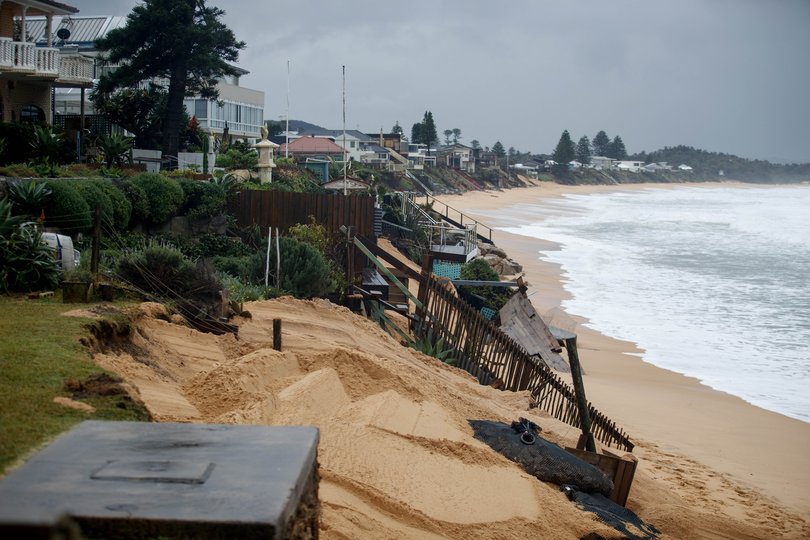
Multi-million-dollar homes on Wamberal Beach are teetering on the edge of collapse as wild surf chews through the shoreline, swallowing front yards and forcing frantic evacuations.
Extraordinary photos show mansions clinging to crumbling cliffs, with sand sucked away by monster swells fuelled by the so-called “bomb cyclone”.
Despite years of warnings and past storms, residents say little has been done to protect the coastline.
“We are stuck in this constant cycle of evacuation,” local Chris Rogers said to News.com.au, who watched his street fall away again this week.
“It’s a joke — one wave away from disaster.”
Minns praises volunteers for battling wild conditions
NSW Premier Chris Minns has praised the efforts of volunteers and workers who braved challenging conditions overnight to protect communities across the state.
He specifically acknowledged the teams who ensured Sydney’s rail network was operational in time for the morning commute.
“There were literally thousands of transport, train, SES and electric crews who worked through the night to resupply power to get transport up and running for the morning peak or to save people as a result of rising flood waters,” he said.
“That’s a difficult job. Everyone tucked up in bed last night would have heard the wind and the rain. The last thing anyone would have wanted to do is be out in that storm.
“There were thousands of people out in that weather to keep us safe.”
Landslide, flipped vehicle on major road
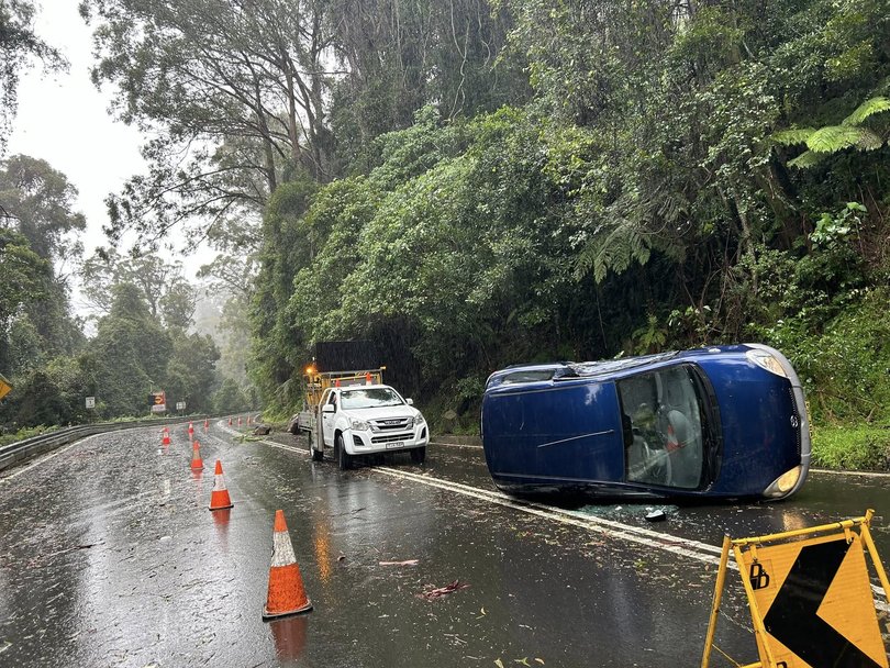
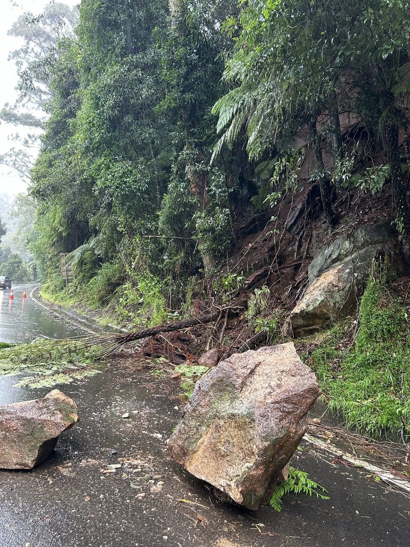
The Albion Park Rural Fire Service has responded to a small landslide and a flipped vehicle on Macquarie Pass, following intense rainfall exceeding 100 millimetres.
In a briefing earlier on Wednesday, NSW Deputy Commissioner Debbie Platz urged all NSW residents to take care on the roads while they are particularly slippery.
Pictured: Road crash rescue in Moss Vale
Photos have emerged from a dramatic rescue late Tuesday evening after a tree fell onto a truck in Moss Vale.
At 10:45pm, NSW SES Wingecarribee and Moss Vale rescue teams responded to the scene, working alongside Fire and Rescue NSW to stabilise the vehicle.
Crews cut away the roof and pried open the dashboard to safely free the trapped driver.
According to reports, the driver is in a stable condition.

More destruction across the state pictured
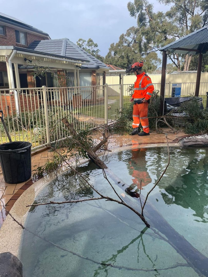
Additional images have emerged, highlighting the extensive damage to properties and train lines across NSW.
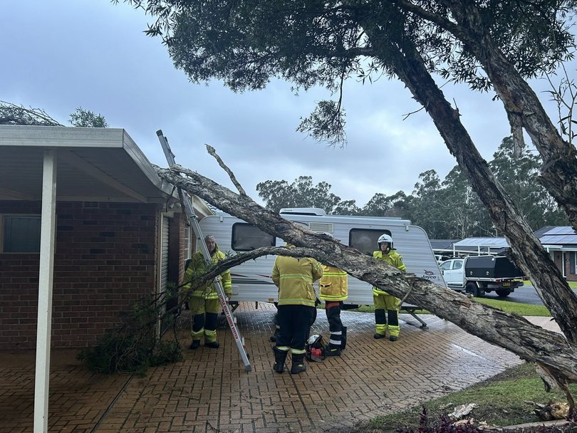
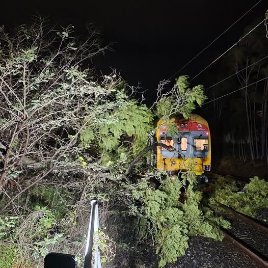
SES issues ‘prepare to evacuate’ warning for Sussex Inlet
The NSW SES has issued a prepare to evacuate warning for residents in the Sussex Inlet due to rising minor flooding.
What can NSW expect today?
Heavy rain will continue to pour across a lot of NSW today, with totals between 50 and 100mm expected. In some areas of the state, 120mm is possible.
“The damaging winds will continue today,” NSW SES Deputy Commissioner Debbie Platz added during a briefing on Wednesday morning.
“60 to 70km/h wind gusts are possible, and in some pockets, potentially up to 100km/h in areas around the South Coast, Mid North Coast…and Sydney metropolitan area.”
While emergency services anticipate conditions will begin to ease later on Wednesday as the powerful system shifts further south and east, Ms Platz warned there is “still potential for riverine flooding, and we at the SES and at the Bureau (of Meteorology) will continue to monitor these risks.”
Minor to moderate flooding is possible in the Hawkesbury and lower Nepean Rivers, while minor flooding is also expected in the Sydney river systems such as the Colo and Georges River.
Flood risks also extend to parts of the Illawarra coast, including the Shoalhaven River, St George’s Basin, Clyde River and the Snowy Mountains River.
“Residents in all of these areas are advised to continually monitor conditions and follow the advice of any flood warnings in the event that their situation will escalate,” she added.
“As we have always said, this system is a more dynamic and fast-moving system than any of the recent rain events we have seen across NSW.”
Seven flood rescues, 2870 incidences reported: SES
The NSW SES flood rescue team was activated “seven times” around the Shoalhaven area overnight due to people driving into floodwaters.
With heavy rainfall and damaging winds continuing on Wednesday, NSW Deputy Commissioner Debbie Platz urged residents in flood-prone areas to “follow the advice of any flood warnings in the event that the situation will escate”.
In addition to the flood rescues, Ms Platz confirmed that since the start of the severe weather event, the SES has reported 2,870 incidents and received 2,391 calls for assistance.
The majority of these incidents have been concentrated in three key regions:
- The Mid North Coast, particularly around Medford, which recorded over 740 calls
- Metropolitan Sydney, with 771 calls
- The Illawarra and South Coast, with 647 calls
‘Flash flooding a key concern’: SES
Flash flooding remains a key concern for the NSW SES as heavy rain continues to lash parts of the state.
NSW SES Deputy Commissioner Debbie Platz said that the areas on high alert include Illawarra, the South Coast and some areas in Sydney.
Ms Platz urged residents to take care on the roads as there have been multiple car crashes due to the slippery conditions.
“That is extremely important, and once again, a reminder to everybody not to drive, play or walk in flooded areas.”
The majority of incidents the SES attended to overnight have been for fallen trees and powerlines on road.
“We are not out the woods yet,” Ms Platz warned.
