‘Very dangerous’: Huge storm set to batter east coast
Australians are being warned to remain ‘vigilant’ as a violent and damaging storm is set to hit in the coming hours.
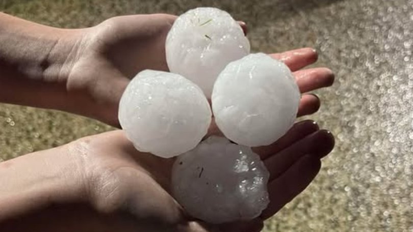
Giant hail stones, severe winds and possible power outages are likely to reach parts of Australia in the next few hours as the BOM warns of a “very dangerous thunderstorm”.
In an update on Saturday afternoon, BOM meteorologist Angus Hines cautioned while thunderstorms are possible across the country on Saturday, the most severe weather will hit the NSW and Queensland border.
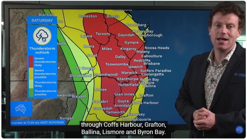
“Severe thunderstorms are possible through the yellow areas of the map and are likley through the red areas,” he said.
Sign up to The Nightly's newsletters.
Get the first look at the digital newspaper, curated daily stories and breaking headlines delivered to your inbox.
By continuing you agree to our Terms and Privacy Policy.“When we see severe thunderstorms a bit later this afternoon they could bring a whole array of weather hazards including heavy to intense rainfall that could bring flash flooding, damaging and destructive wind gusts and large to giant-sized hail.”
He even forecasted the outside chance of tornadoes hitting in the most intense parts of the storm.
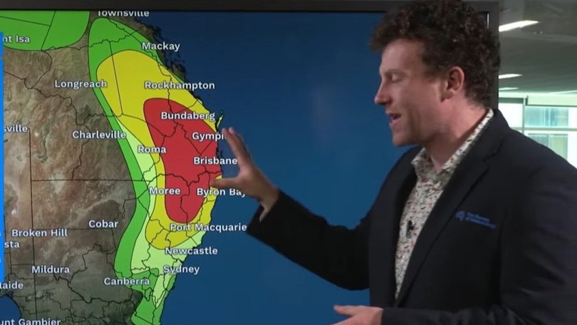
In NSW, Mr Hines warned the high risk areas were in the Northern Tablelands and parts of the Northern Rivers, mid North Coast, Hunter and Central Tablelands districts.
The warning extends to regions including Armidale, Glen Innes, Tabulam, Urbenville, Jackadgery and Ebor, over the next several hours.
While in Queensland the high risk area is out towards the coast including the highly populated areas of Surfers Paradise, the Gold Coast, Brisbane metro area, the Sunshine Coast, Maleny and Noosa Heads.
Locals in inland areas through the Burnett region, Kingaroy, Gympie, Rolleston and Roma could also be impacted by the storm.
The weather bureau urged those in the path of the storm to stay indoors, move their cars undercover or away from trees, secure loose items around the house and to stay at least eight metres from any fallen powerlines.
“Stay indoors away from windows, and keep children and pets indoors as well,” the warning reads.
“Stay vigilant and monitor conditions.”
The storms are part of a weekend of wild weather, with Sydneysiders jolted awake by powerful storms, lightning strikes and severe rain in the early hours of Saturday morning.
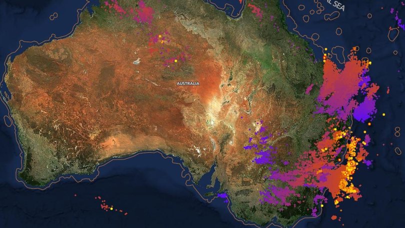
Bureau of Meteorology meteorologist Jonathan How said Saturday would be the peak of the multi-day severe weather warning.
Areas likely to be impacted include Brisbane, parts of the Gold Coast, Sunshine Coast, and inland communities like Toowoomba, Dalby, and Kingaroy, and down towards Glen Innes and Moree in northern parts of New South Wales.
“We may see life-threatening flash flooding with intense rainfall, giant hail, and destructive winds. And with some of these more intense supercell thunderstorms moving through, we can’t rule out the possibility of tornadoes,” Mr How said.
This follows severe storms which swept across the country on Friday night, forcing the cancellation of Halloween celebrations, including Sydney’s Ghost Festival - although some brave souls tried to keep the party going.

In Sydney’s west Penrith residents reported severe rain and hail.
While further north, those in Queensland said a storm rolled through bringing heavy rain and lightning to areas around Brisbane.
Earlier in the day, the South Burnett and the Sunshine Coast regions were smashed by hail as the severe weather system swept south.
Mr How urged households to make sure they stay up to date with the latest warnings.
“For impacts, what can we expect? With large hail and destructive winds, this could cause damage to trees and property,” he said.
“Flash flooding can make travel and driving conditions quite dangerous. With some of those more intense thunderstorms, we could also see power and utility outages throughout the day.”
Senior meteorologist Kimber Wong told NewsWire this weekend’s wild weather is not out of the ordinary for Queenslanders.
While the storms are potentially more destructive than normal, wild weather is nothing out of the ordinary for South East Queensland.
“We’re at the end of October – it’s peak storm season, so it’s not totally uncommon to see storms this time of year,” she said.
“As we’ve seen in recent storm outbreaks within the past couple of weeks, storms this type of year can really pack quite a punch.”
By Sunday conditions are expected to ease, although there are still warnings of showers across the east coast and isolated thunderstorms.
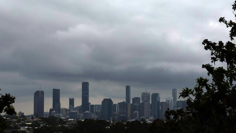
Brisbane households can expect showers in the morning, with storms developing, reaching a top of 27 degrees.
Sydneysiders will also need to get the umbrella ready, with a shower or two forecast and a possible storm later in the day. It will reach a maximum of 25 degrees.
It will be a wet and soggy day in Sydney, with showers forecast in the afternoon and a top of 25C.
Melbourne will be spared most of the wild weather, with a likely overcast and cloud day, although it will be cooler, reaching just 21C.
The nation’s capital is expecting similar weather, with Canberra being partly cloudy and a low change of rainfall, with a maximum temperature of 24C.
It will be partly cloudy in Hobart, but there is currently no rain expected and a maximum temperature of 20C expected.
It is also expected to be a nicer day in Adelaide, with the threats of thunderstorms subsiding. The BOM now expects a mostly sunny day, with a maximum temperature of 27 degrees.
Perth is also expected to miss the wild weather, with a partly cloudy day and a maximum temperature of 21C.
Conditions will be partly cloudy in Perth, with a high chance of showers in the afternoon and evening, reaching a top of 24C.
Darwin will be warmer and is expected to reach 34C on Saturday, although there is a chance of a shower or two.
Originally published as ‘Very dangerous’: Huge storm set to batter east coast
