Cyclone Fina: ‘Seek shelter’ order for Darwin as Cyclone Fina bears down on the Top End
Residents are on high alert and have been ordered to seek shelter with Tropical Cyclone Fina expected to restrengthen as it tracks toward the coast.
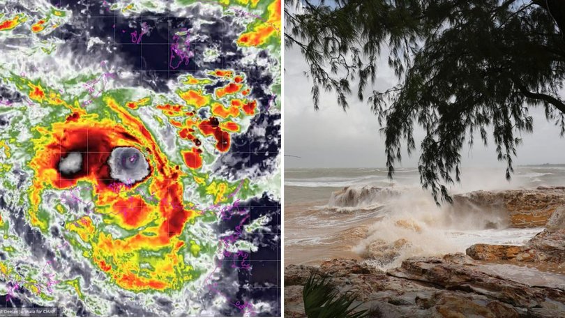
Darwin residents have been urged to stay indoors and prepare for worsening conditions as Tropical Cyclone Fina edges closer to the Top End, bringing the threat of destructive winds, torrential rain and dangerous seas over the next 24 hours.
Emergency services have escalated warnings and issued a formal “seek shelter” order for surrounding areas, telling people to secure properties, stay off the roads and move to their safest room or designated shelter.
The intensifying system is forecast to track near the coast and make landfall later today, with authorities warning conditions could deteriorate rapidly as the core of Fina approaches.
Sign up to The Nightly's newsletters.
Get the first look at the digital newspaper, curated daily stories and breaking headlines delivered to your inbox.
By continuing you agree to our Terms and Privacy Policy.The cyclone has reduced in intensity to a category one system but is expected to restrengthen, with forecasters saying there’s a chance it could go to a more destructive category three.
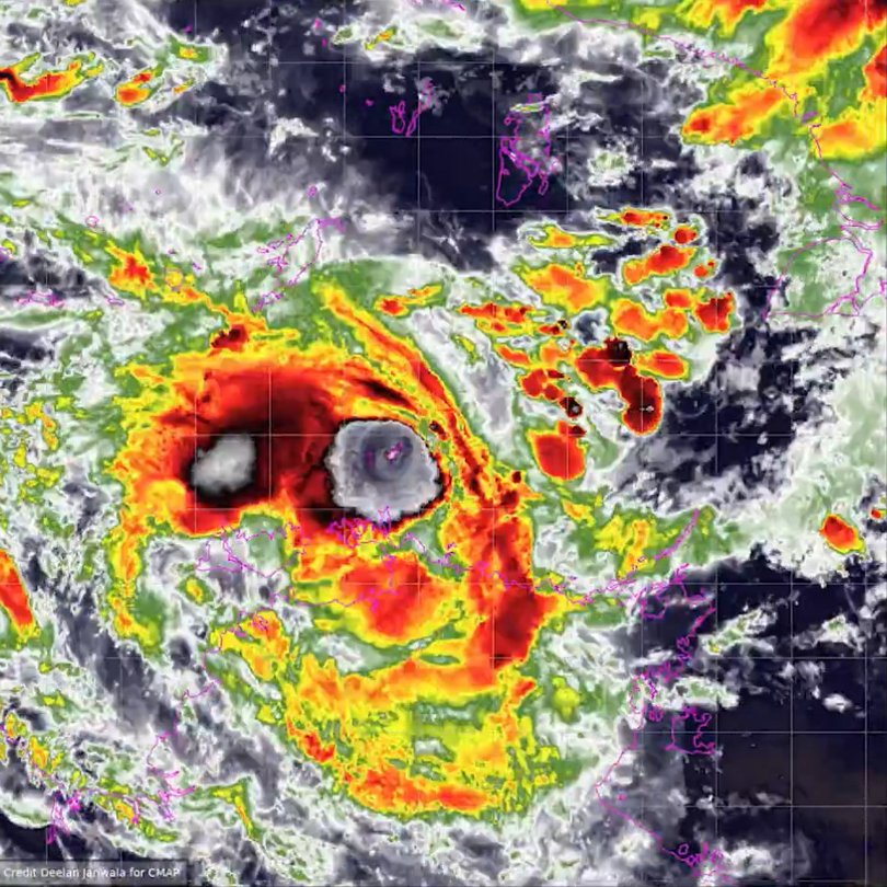
Early on Friday, the category one system had sustained winds of 75km/h with wind gusts to 100km/h, and was about 340km northeast of Darwin, moving slowly.
The Bureau of Meteorology said a warning zone was in place early on Friday for the Tiwi Islands and Cape Hotham to Warruwi, including the Cobourg Peninsula, Minjilang and Gunbalanya.
Darwin is included in a watch zone in place for the Daly River Mouth to Cape Hotham, including Dundee Beach.
The system was expected to strengthen to category two while tracking southwest during Friday and approaching the Cobourg Peninsula and Tiwi Islands on Friday night.
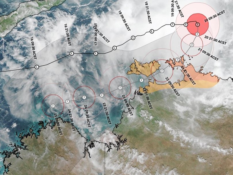
It would then continue southwest through the Van Diemen Gulf on Saturday, heading west towards Darwin.Fina is forecast to further intensify to a severe tropical cyclone during Sunday afternoon in the southern Timor Sea.
“There continues to remain a chance it could reach category three intensity earlier, during late Friday or early Saturday as it moves into the Van Diemen Gulf,” the bureau said in an update early on Friday.It warned of gales with damaging wind gusts to 120km/h over the Cobourg Peninsula on Friday morning, with gales expected to extend further west to include the Tiwi Islands late on Friday, and Darwin during Saturday.
Destructive wind gusts to 155km/h may develop between Cape Don and Warruwi on Friday as the system nears the coast, extending to the Tiwi Islands early on Saturday and possibly to Darwin later in the day.The bureau warned heavy rain could cause flash flooding in coastal areas between the Tiwis and Warruwi from Friday, extending to the coast and nearby inland, including Darwin on Saturday.
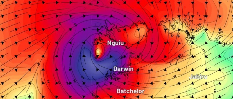
The Northern Territory Emergency Service is warning people near Minjilang to complete preparations quickly and be prepared to shelter in a safe place.
It is warning people on the Tiwis and near and between Cape Hotham and Warruwi, including the Cobourg Peninsula, to secure boats and property.
Residents threatened by Fina across the Top End have been stocking up on basics with bottled water, bread, canned goods and other household supplies flying off supermarket shelves.
The bureau’s cyclone track map shows Fina passing just north of Darwin, where residents have been warned to expect intense weekend rainfall and dangerous winds with the possibility of destructive gusts.
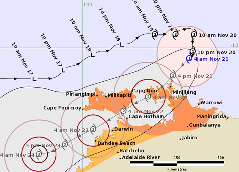
There was the potential for flash flooding, property damage, felled trees and power outages.
People have been urged to ensure they have a cyclone plan and to shelter at home, with most of Darwin’s buildings made to withstand cyclone conditions.
The city has not experienced a cyclone since category two system Marcus cut power to nearly 29,000 properties in March 2018.
Cyclone Tracy was the most devastating system to hit Darwin, killing 66 people after it was destroyed on Christmas Day in 1974.
with AAP

