Western Australia hit by heatwave as possible cyclones threaten to impact coast this week
‘This is probably the one that would be most likely to have a direct impact on the mainland.’

Western Australia is expected to be hit by multiple weather events this week, as severe heatwave conditions continue and a new cyclone threat looms.
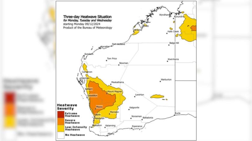
Severe heatwave conditions continue to bake parts of the states, with the worst of the heat to begin making its way southwest towards the coast.
Maximum temperatures are expected to peak in the mid 30C to mid 40C, with overnight minimum temperatures in the mid to high 20s.
Sign up to The Nightly's newsletters.
Get the first look at the digital newspaper, curated daily stories and breaking headlines delivered to your inbox.
By continuing you agree to our Terms and Privacy Policy.The Bureau of Meteorology (BOM) said large areas experiencing severe heat wave conditions were not expected to find relief until the weekend.
“A trough along the coast is pulling down some warm air over those areas around the southwest of the state,” forecaster Daniel Hayes said.
Perth will reach a high of 34C on Monday, with the temperature expected to peak on Wednesday with a high of 38C.
Residents in the state’s capital are warned the heat is not expected to ease until Saturday.
“Until we see this next through move through inland, pulling some moisture down, and we see more rain and storm activity into those southwestern parts, it will remain quite hot,” Hayes said.

Busselton, Bunbury and Mandurah are all expected to hit the mid 30s this week, while Moora is expected to experience 40C on Monday, peaking at 42C on Wednesday.
BOM said severe heatwaves could be dangerous for older people, babies, children, pregnant and breastfeeding women, people with medical conditions and people who are unwell.
“People are advised to seek a place to keep cool, such as your home, a library, community centre or shopping centre,” they said.
“Close your windows and draw blinds, curtains or awnings early in the day to keep the heat out of your home.
“If available, use fans or air-conditioners to keep cool.”
The next heatwave warning will be issues at 2pm (WST) on Monday.
Cyclone threat
Meanwhile, as the state battles heat wave conditions, a cyclone threat looms off the Timor sea.
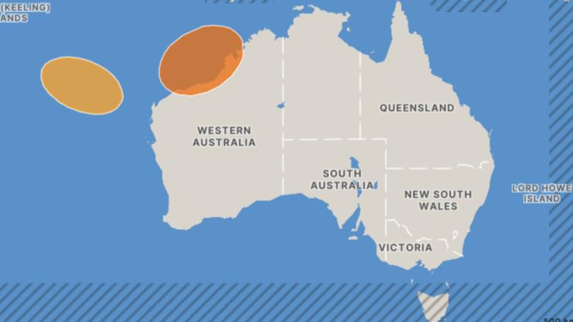
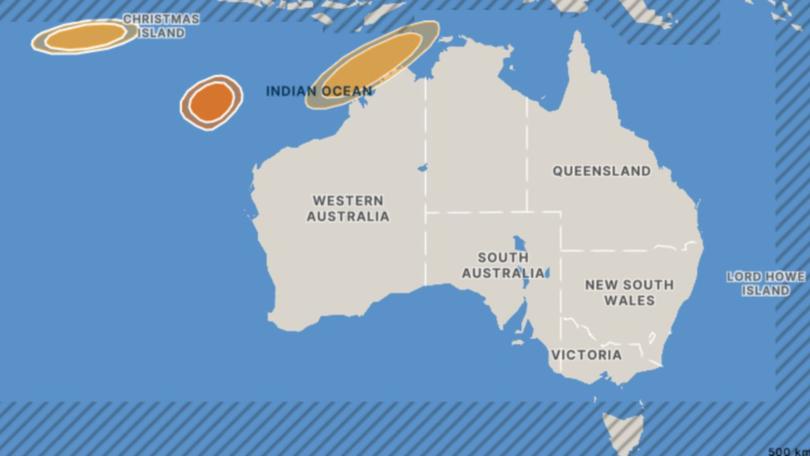
Three tropical lows are expected to form off the WA coastline in the next few days.
One tropical low, numbered 05U by BOM, currently has a moderate risk of forming into a cyclone over the weekend.
“This is probably the one that would be most likely to have a direct impact on the mainland,” Hayes said.
05U is expected to form over the Timor Sea or Arafura Sea in coming days.

“Even if it doesn’t get to cyclone strength it could still be a significant system, and (lead to an) increase in rain, storms and (an) extended period of winds.
“There’s still a bit of time at this point, but certainly one would hope that most people’s preparations are well in hand by now,” Hayes said.
If 05U forms, it will likely track to the southwest near the coast and would develop if it remained over water, potentially into a small but significant system, according to BOM.
“At this stage, there is considerable variation in possible outcomes,” BOM said.
BOM said the risk of a tropical cyclone forming was more likely over Saturday and Sunday.
“People in Kimberley and Pilbara coastal communities should stay up-to-date with the latest forecasts in case the threat increases,” it warned.
Two other low pressure systems are also forming off the WA cost, where a weak tropical low, 02U, is forming along a trough west of the Kimberley coast.

“The low is expected to move to the west southwest, roughly parallel to the Pilbara coast and remain well offshore,” BOM said.
“There is a slight, moderate risk for a period from late Tuesday into Wednesday where 02U may develop into a tropical cyclone, but no impacts to coastal communities are expected.”
Another tropical low, 03U, may increase shower and thunderstorm activity over the Christmas and Cocos (Keeling) Islands from later Wednesday.
Cyclone season in Australia is between November and April, with the first tropical cyclone of the season, named Robyn, already forming west of the Cocos (Keeling) Islands at the end of November.
If 05U forms, it will be the first cyclone to hit the Australian coastline this season.
Originally published on 7NEWS
