Queensland on cyclone alert for upcoming summer as dangerous storms swirl for fifth straight day
Supercell storms have battered millions of Australians with hail, damaging winds and heavy rain.
Queenslanders are being warned at least one cyclone will make landfall this summer, but it may be more severe due to warmer water temperatures.
The high-risk weather season has begun in the Sunshine State, with bushfires spreading due to heavy rain in previous months providing plenty of fuel.
WATCH THE VIDEO ABOVE: Wild weather causes disruptions
Sign up to The Nightly's newsletters.
Get the first look at the digital newspaper, curated daily stories and breaking headlines delivered to your inbox.
By continuing you agree to our Terms and Privacy Policy.Queensland Police Deputy Commissioner and State Disaster Co-ordinator Shane Chelepy said more than 1.25 million hectares of land had burned since the fire season started in July.
There have been no deaths, but one residence was destroyed in Forsayth, in the state’s Gulf Country, in a blaze earlier this week.

The Bureau of Meteorology warns fire conditions will continue over the next few months.
The warning should be heeded in areas not yet impacted by summer storm cells ripping across the state, with one drenching Brisbane in more than 50mm of rain in an hour on Wednesday night.
“The outlook for the next couple of months where we haven’t seen that rainfall, conditions are still ripe for very dangerous bushfires to occur,” meteorologist Kimba Wong told reporters on Thursday.
“Once we do start to see rainfall and conditions wetting out, that bushfire risk does decrease.”
The storms are expected to continue for some months with typical conditions where three air masses collide - an inland trough, a southeasterly wind and warm, moist northeastern air - to create the dangerous conditions.
“That’s why we typically see some of these storms impacting southeast Queensland in the later afternoon,” Wong said.

Chelepy said it had already been an active storm season, but the state had come out “relatively unscathed”.
However, some communities copped the brunt of the damage with one quarter of homes in Julia Creek, in northwest Queensland, impacted during Monday’s storm with 146km/h winds.
The bureau said it would be an average season with at least one tropical cyclone making landfall and three others remaining off the coast.
But it warns the cyclone may be more severe than usual, with ocean temperatures reaching near-record highs and providing greater energy to weather systems.
Chelepy urged Queenslanders to prepare for extreme weather events.
“No matter where you live in Queensland, you will be at some sort of risk whether it be storm, fire, flood or cyclone,” he said.
He said it appeared residents were becoming storm weary and not heeding warnings, urging Queenslanders to remain alert.
“You will not get warnings for your street or your house, so you need to understand what those warnings mean for you.”
Wild weather continues to batter southeast Queensland
Queensland has been battered by wild weather this week, with more than 200,000 lightning strikes recorded on Wednesday night alone.
Supercell storms have battered Brisbane and the southeast with hail, damaging winds and heavy rain.
Green skies spread over the southeast on Wednesday, with golf-sized hail dropped over parts of Ipswich, Logan and the Darling Downs.
Approximately 1700 homes and businesses were left without power after Wednesday’s weather, and Energex worked to restore the majority by 10am on Thursday.
“There were more than 200,000 lightning strikes last night — that’s about 50 a minute or about eight a second,” Energex spokesperson Chris Graham said.
“We did see rainfall totals in a very short period of time, exceeding 50mm in an hour,” Bureau of Meteorology spokesperson Kimba Wong said.
“And that was at a number of sites across Brisbane and the southeast.
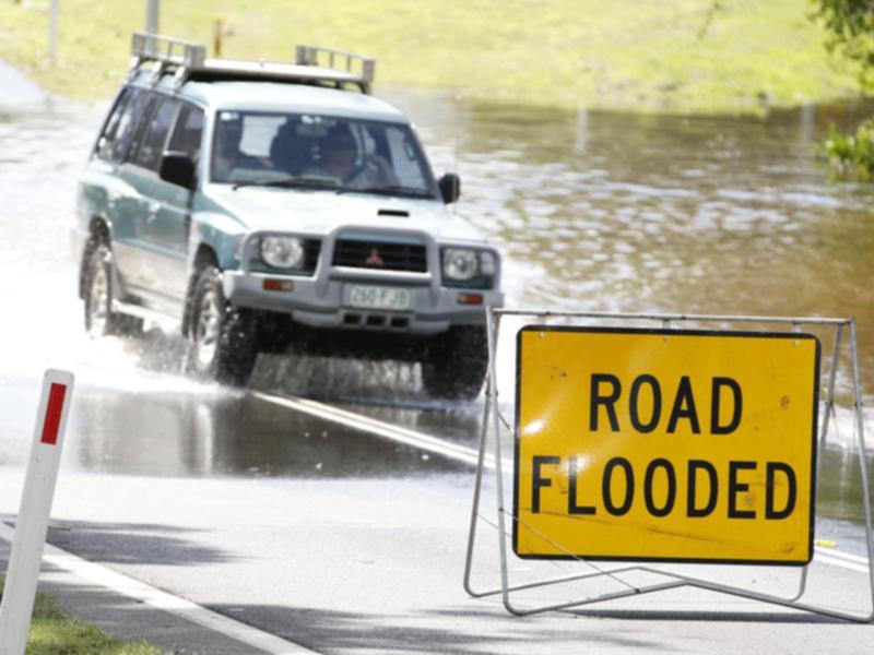
“When we start to talk about this short duration heavy rainfall, that’s when we have a risk of flash-flooding impacts.
“So, it’s really important that you understand the risk (and) the forecast for storms ahead.
“Every single thunderstorm can be dangerous, because it contains lightning.
“But we issue severe thunderstorm warnings for those that may result in rainfall rates that lead to flash-flooding.
“Also storms that may produce large hail, which is in excess of 2cm in diameter, damaging wind gusts in excess of 90km/h and potentially tornadoes as well.”
- with AAP
Originally published on AAP/7NEWS
